ExecutiveBiz - Latest Federal & Government Contracting Companies' News Coverage
Breaking
Top Stories
Iron Bow Promotes Kevin Greene to VP of Business Development; Rene LaVigne Quoted
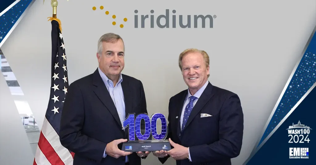
Iridium CEO Matt Desch Presented With 10th Wash100 Award
LMI Names Patrick Mahoney, Ryan Harth to VP Roles
SSC Seeks Satellite-Based Weather Sensing Technologies for DOD Forecasting Needs
Rocket Lab USA Deploys 2 Satellites to Separate Orbits for NASA, KAIST
Oshkosh Defense to Deliver Additional ROGUE-Fires Unmanned Ground Vehicles to Marine Corps
Mike King Named Advisory Board Member at RIVA Solutions
RTX Kicks Off Expansion of Raytheon Missile Integration Facility in Alabama; Phil Jasper Quoted
RTX Kicks Off Expansion of Raytheon Missile Integration Facility in Alabama; Phil Jasper Quoted
RTX Kicks Off Expansion of Raytheon Missile Integration Facility in Alabama; Phil Jasper Quoted
BeyondTrust Gets FedRAMP Moderate Accreditation for Remote Support and Access Offering
Brian Fitzpatrick Appointed QinetiQ US Business Development VP
Spirent Federal Systems Appoints Retired Space Force Gen. David Thompson as Adviser
CGI Federal’s Fed Future 2030 Campaign Imagines a Modernized Tomorrow for Government Services
Joanne Gladden Promoted to SVP of Climate Science at Alpha Omega; Gautam Ijoor Quoted
Tyto Lands $168M Army Network Infrastructure Modernization Award; Dennis Kelly & Peter O’Donoghue Quoted
Today's headlines
Lisa Talcott Assumes Vice President Role at Procentrix
RTX Kicks Off Expansion of Raytheon Missile Integration Facility in Alabama; Phil Jasper Quoted
RTX Kicks Off Expansion of Raytheon Missile Integration Facility in Alabama; Phil Jasper Quoted
Oshkosh Defense to Deliver Additional ROGUE-Fires Unmanned Ground Vehicles to Marine Corps
LMI Names Patrick Mahoney, Ryan Harth to VP Roles
Joanne Gladden Promoted to SVP of Climate Science at Alpha Omega; Gautam Ijoor Quoted
Tyto Lands $168M Army Network Infrastructure Modernization Award; Dennis Kelly & Peter O’Donoghue Quoted
Rocket Lab USA Deploys 2 Satellites to Separate Orbits for NASA, KAIST
Brian Fitzpatrick Appointed QinetiQ US Business Development VP
Lisa Talcott Assumes Vice President Role at Procentrix
Iridium CEO Matt Desch Presented With 10th Wash100 Award
Iron Bow Promotes Kevin Greene to VP of Business Development; Rene LaVigne Quoted
CGI Federal’s Fed Future 2030 Campaign Imagines a Modernized Tomorrow for Government Services
DOD Taps Intel Foundry for Commercial Chip Fabrication Program’s Phase 3
RTX Kicks Off Expansion of Raytheon Missile Integration Facility in Alabama; Phil Jasper Quoted
Lockheed Martin Hands Over Long Range Discrimination Radar to MDA
Mike King Named Advisory Board Member at RIVA Solutions
BeyondTrust Gets FedRAMP Moderate Accreditation for Remote Support and Access Offering
SSC Seeks Satellite-Based Weather Sensing Technologies for DOD Forecasting Needs
Spirent Federal Systems Appoints Retired Space Force Gen. David Thompson as Adviser
Featured Articles
Articles
/ 6 days ago
GSA Contracting 101: Everything Government Contractors Should Know
Articles
/ 7 days ago
Federal News: Exploring the Trends and Innovations in Government Contracting
Articles
/ 1 week ago
Federal Remote Work: Policies, Trends, and Opportunities
Articles
/ 2 weeks ago
VA Funding Cut: What Are Its Implications for Veterans?
Articles
/ 2 weeks ago
Top Government Events in 2024
Articles
/ 2 weeks ago
The Definitive Guide to CIO-SP4: What Contractors Need to Know
Articles
/ 3 weeks ago
Doug Cossa: Champion of Intelligence and 5th Annual CIO Summit Keynote Speaker
Articles
/ 3 weeks ago
Matt Desch: A Decade of Leadership, Success, and Innovation
Articles
/ 4 weeks ago
Kathleen Hicks: Deputy Secretary of Defense Wins 4th Wash100 Award
Articles
/ 4 weeks ago
Gen. Charles Brown Jr.: Chairman of CJCS Wins Wash100 Award in 2024
Articles
/ 1 month ago
AI Leaders: Executives Revolutionizing the Artificial Intelligence Realm in 2024
Articles
/ 1 month ago
Zero Trust: What is It and How Does It Affect the US Air Force
Articles
/ 1 month ago
Vincent Bridgeman: Redhorse Corp. SVP Joins the 5th Annual AI Summit
Articles
/ 1 month ago
Michaela Mesquite: ODNI Executive is a Panelist for the 5th Annual AI Summit
Articles
/ 1 month ago
Tom Arseneault: A Look into BAE System CEO's Wash100 Awards
Articles
/ 2 months ago
Alain Cohen: Moderator for the POC’s Achieving Transformative Cooperation for National Defense Forum
Articles
/ 2 months ago
Lt. Gen. Heath Collins: Keynote for the Potomac Officers Club's 2024 Space Summit
Articles
/ 2 months ago
Chance Saltzman: U.S. Space Force's Chief of Space Operations is a Wash100 Award Winner in 2024
Articles
/ 2 months ago
Young Bang of the U.S. Department of Army's Journey to Bagging His First Wash100 Award
Articles
/ 2 months ago
Kim Lynch: Oracle’s Executive VP Wins Her First Wash100 Award in 2024
Articles
/ 3 months ago
Dr. William Streilein Keynotes Potomac Officer Club's Upcoming 5th Annual Artificial Intelligence Summit
Articles
/ 3 months ago
The Evolving Landscape of Government Contracting: Why Networking Matters More Than Ever
Articles
/ 3 months ago
Military Retention Rates: How to Increase the Numbers
Articles
/ 3 months ago
Maynard Holliday, PTDO Assistant Secretary of Defense for Critical Technologies, is a Panelist for the POC's 10th Annual R&D Summit
Articles
/ 3 months ago
General Stephen Whiting, USSPACECOM Commander, to Deliver the Opening Keynote at the 2024 Space Summit
Articles
/ 3 months ago
Juan Ramirez, Director, 5G Cross Functional Team of Chief Information Officer U.S. Department of Defense
Articles
/ 3 months ago
Shankar Rachakonda, CEO of Radiant Digital, Introduces Keynote Speaker at The CX Imperative Forum
Articles
/ 3 months ago
Victor Udoewa, Service Design Lead, OPHDST - Centers for Disease Control and Prevention, Panel Speaker at the CX Imperative Forum
Articles
/ 4 months ago
Karen Howard from the IRS Speaks for the POC’s CX Imperative Forum
Articles
/ 4 months ago
Aditi Kumar, DIU's Deputy Director, to Keynote the 10th Annual Defense R&D Summit
Articles
/ 4 months ago
Tom Drake Of The Office Of Naval Research (ONR) Speaks To Potomac Officers Club's 10th Annual Defense R&D Summit
Articles
/ 4 months ago
Dr. Randy Yamada Graces POC's Event: The 10th Annual Defense R&D Summit
Articles
/ 4 months ago
Cybersecurity Mandates: Keeping Up with the Federal Government's Standards
Articles
/ 4 months ago
Jesse Black, Commanding Officer Of U.S. Naval Research Laboratory (NRL), Panelist At 10th Annual Defense R&D Summit
Articles
/ 4 months ago
DHS' Dana Chisnell Speaks at the Potomac Officers Club's Radiant-Sponsored Digital CX Imperative Forum
Articles
/ 4 months ago
SVP Jeffery McLaughlin of Radiant Digital, Moderator at The CX Imperative Forum, hosted by Potomac Officers Club
Articles
/ 4 months ago
Dr. William Casebeer, Director of Riverside Research for AI and ML, Joins the 10th Annual Defense R&D Summit
Articles
/ 5 months ago
Patrick Baker from U.S. Army Combat Capabilities DEVCOM Is a Panelist for the 10th Annual Defense R&D Summit
Articles
/ 5 months ago
James McHale from Crowley Government Services Joins the DOD Forum to Achieve Audit Readiness
Articles
/ 5 months ago
Brian Lein, Assistant Director of Health Care Administration (AD-HCA)
Articles
/ 5 months ago
Brigadier General John M. Cushing to Speak for the 10th Annual Defense R&D Summit
Articles
/ 5 months ago
Lisa Gardner, Keynote Speaker Introducer at the 2023 Healthcare Summit Hosted by the Potomac Officers Club
Articles
/ 5 months ago
Meet Industry Leader Doug Wagoner, CEO of LMI
Articles
/ 5 months ago
Alvaro Velasquez, Program Manager at Defense Advanced Research Projects Agency (DARPA
Articles
/ 5 months ago
Ken Hofgesang Introduces Tracy Farrill at the POC-Hosted 2023 Healthcare Summit
Articles
/ 5 months ago
What Can An F-35 Lightning II Do Better Than Others Of Its Kind?
Articles
/ 5 months ago
Richard Kniseley is a Panelist at the Potomac Officers Club's 2024 Space Summit
Articles
/ 5 months ago
Thanatos: Overview of the Much-Awaited Stealth Drone
Articles
/ 5 months ago
Terminal High Altitude Area Defense (THAAD) System Seen Combat: Fact Sheet Display
Articles
/ 5 months ago
Chief Scientist Dr. Mark Linderman Speaking at Potomac Officers Club's Workloads at the Tactical Edge Forum
Articles
/ 5 months ago
Thomas "Pat" Flanders, PEO and CIO at Defense Health Agency
Articles
/ 5 months ago
Why the Continuing Resolution Debate Matters: Key Considerations for Citizens and Stakeholders
Articles
/ 6 months ago
Heidi Shyu: Beacon of Technological Innovation in Defense
Articles
/ 6 months ago
Spotlighting Tadgh Smith, Deputy Assistant Director of DHS/ICE
Articles
/ 6 months ago
Tracy Farrill: Interim Director at Defense Health Network Continental
Articles
/ 6 months ago
A Comprehensive Guide to Navy Ranks: From Ensign to Admiral
Articles
/ 6 months ago
Public-Private Partnerships: How the Federal Government is Collaborating with the Private Sector
Articles
/ 6 months ago
HIMARS in Action: The Role of Multiple-Launch Rocket System in Global Conflicts
Articles
/ 6 months ago
Federal Budget Allocation: Unpacking the Spending Priorities for the Coming Year
Articles
/ 6 months ago
Army Spending Breakdown: The Cost of Security and Where Our Taxes Are Going
Articles
/ 6 months ago
United States Debt Ceiling: Preventing a Default on National Debts
Articles
/ 6 months ago
Understanding the Current Inventory: How Many Tanks Does the US have in its Military Arsenal?
Articles
/ 6 months ago
Iron Dome in Action: Probing Israel’s Air Defense System
Articles
/ 6 months ago
Exploring the Top 10 Government Technology Events, Conferences, and Summits
Articles
/ 6 months ago
Albers Aerospace's Leaders, Founders, Execs: Who Are They?
Articles
/ 6 months ago
Government Shutdown: What Happens During a Temporary Shutdown Aversion?
Articles
/ 7 months ago
Behind the Scenes: How Military Weapons are Developed and Tested
Articles
/ 7 months ago
Exploring the Legacy of Sikorsky Helicopters: Innovations and Evolution
Articles
/ 7 months ago
Healthcare Executives Inspiring Change in 2023
Articles
/ 7 months ago
NGA Director Frank Whitworth III Receives Second Wash100 Award
Articles
/ 7 months ago
Notable Chief Technology Officers Impacting The Industry
Articles
/ 7 months ago
Who Are the US Allies: A Comprehensive Guide to America's Key International Partnerships
Articles
/ 7 months ago
7 Space and Mission Companies Pioneering the Cosmos
Articles
/ 7 months ago
Masters of Trade: 5 Sales Executives Shaping the Public Sector
Articles
/ 7 months ago
Top 5 National Security Executives to Follow in 2023
Articles
/ 7 months ago
Noteworthy Contracts and Procurement Executives To Follow in 2023
Articles
/ 7 months ago
Federal Agencies: A Guide to Government Websites
Articles
/ 7 months ago
Meet Altamira’s Leaders, Founders, Execs: Who Are They?
Articles
/ 7 months ago
Emerging Artificial Intelligence Innovators to Watch in 2023
Articles
/ 7 months ago
5 Inspiring Women Executives Serving The Government In 2023
Articles
/ 7 months ago
The Top 10 Government Cloud Events, Conferences, and Summits
Articles
/ 7 months ago
5 Multidomain Missions Leaders Shaking the GovCon Industry in 2023
Articles
/ 7 months ago
A Look into Aeyon's Leaders, Founders, Execs: Who are They?
Articles
/ 7 months ago
A Look Into Ronald "Fog" Hahn: Chief Growth Officer at Client Solution Architects
Articles
/ 7 months ago
7 Influential Chief Financial Officers
Articles
/ 7 months ago
5G Leaders And Executives To Watch In 2023
Articles
/ 7 months ago
10 AI Companies Targeting Industry Breakthroughs in 2023
Articles
/ 7 months ago
Delve Into Advanced Technology International's Leaders, Founders, & Execs: Who Are They?
Articles
/ 8 months ago
A Look Into Dan Corbett: Chief Executive Officer of Valiant
Articles
/ 8 months ago
The Most Recent Top Government Contracts Won By Akima, LLC
Articles
/ 8 months ago
Airbus U.S. Space & Defense, Inc.'s Leaders, Founders, Execs: Who Are They?
Articles
/ 8 months ago
The Top Government Contracts Won by Altamira Technologies
Articles
/ 8 months ago
Top Government Contracts Won by Advanced Research Projects Agency–Energy (ARPA–E) in 2023
Articles
/ 8 months ago
Top Government Contracts Won By Air Force Research Lab (AFRL)
Articles
/ 8 months ago
Top Government Contracts Won by Amazon Web Services
Articles
/ 8 months ago
Top Government Contracts Won by Advanced Technology International (ATI)
Articles
/ 8 months ago
Top Government Contracts Won by Airbus U.S. Space Defense, Inc.
Articles
/ 8 months ago
Listing the Top Government Contracts Won by Aeyon
Articles
/ 8 months ago
AAR Corp.'s Foundation, History, and Significant Achievements
Artificial Intelligence News
contract awards
Oshkosh Defense to Deliver Additional ROGUE-Fires Unmanned Ground Vehicles to Marine Corps
Oshkosh's defense business unit has secured a $40 million contract from the Marine Corps Systems Command to build and deliver Remotely Operated Ground Unit for Expeditionary Fires carriers for use in the service branch's ground-based, anti-ship missile launcher. The delivery order covers the procurement of the ROGUE-Fires carriers in support of the Navy Marine Expeditionary Ship Interdiction System, the Department of Defense said Tuesday.
Tyto Lands $168M Army Network Infrastructure Modernization Award; Dennis Kelly & Peter O’Donoghue Quoted
Raytheon Books $213M Navy Award for Ship Combat System Maintenance, Modernization
Raytheon Books $213M Navy Award for Ship Combat System Maintenance, Modernization
Honeywell Books $70M DLA Contract for Radar Altimeter System Spares
BlueHalo, Stellar Sciences Tapped to Support AFRL’s Satellite Assessment Center
CACI Secures $1.3B Communications & IT Support Task Order for EUCOM, AFRICOM; John Mengucci Quoted
Executive Moves
financial reports
m&a activity
Space News
cybersecurity news
© 2022 Copyrights Executive Mosaic - All Rights Reserved


